The Opening Programme
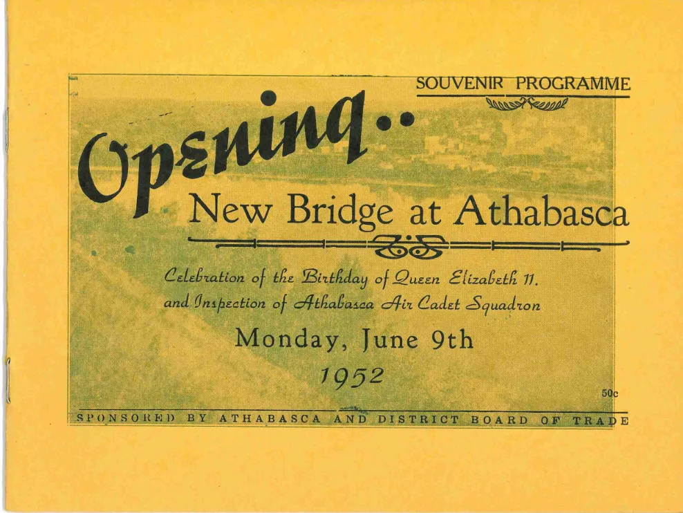
Souvenir programme for the opening ceremonies of the new Athabasca Bridge on Monday, June 9th, 1952.

Copied from the “New Bridge at Athabasca, Monday, June 9th 1952" programme:
“Construction of the new (and first) bridge over the Athabasca River in the easterly portion of the Town of Athabasca, began on December 1st, 1950, and was completed on March 31st, 1952. Gordon Harps, Bridge Foreman, and a crew of thirty men, all from the Bridge Branch of the Department of Highways, built the bridge under the supervision of L. G. Grimble, Chief Bridge Engineer, and his staff, who designed the structure."
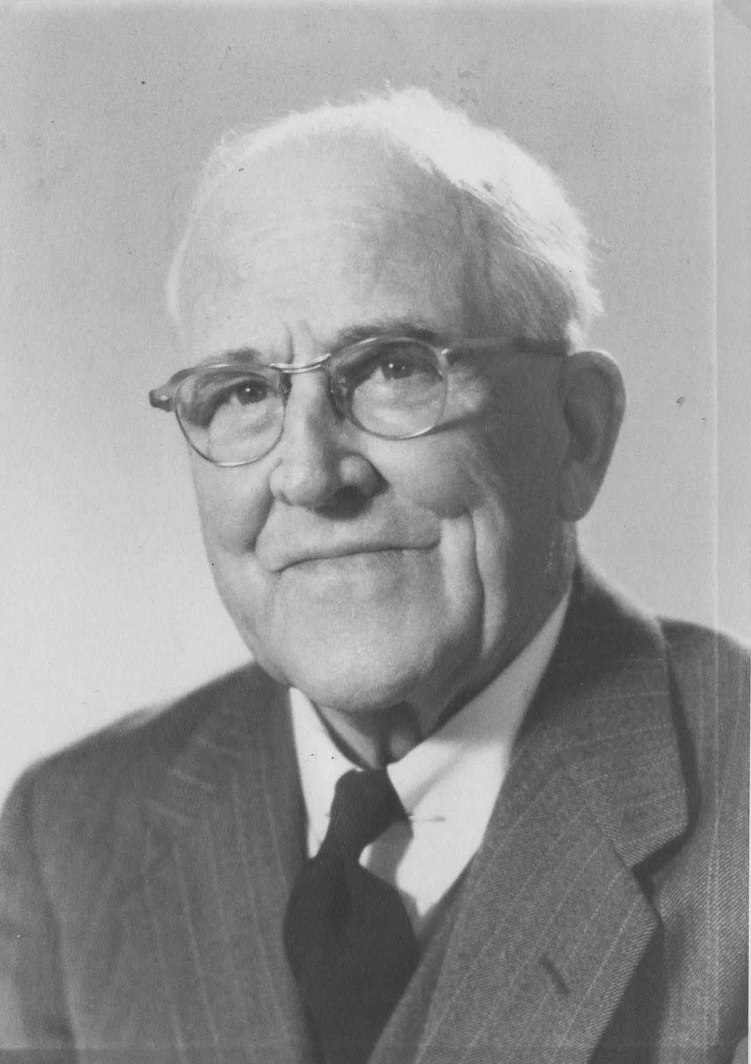
John Philip Evans
"A New Era! . . . by J. P. Evans . . . in Reminiscent Vein
The opening of the new bridge at Athabasca is the happy culmination of prolonged effort, appeal and optimism, and is a source of much satisfaction to many of the old-timers who gave time and energy, enterprise, optimism . . .. often enduring heartbreak and discouragement. The discarded ferry, and in the Fall and Spring the cable manipulated cage, were a decided improvement over the antiquated system of a row boat. And now a bridge!
The Athabasca River at this point was ever a source of mystery and adventure. Its major use was one of transport facilities for penetration to the North; its service was one if not the only means of access to the lands of Peace River and to the great trading area of the Mackenzie river basin. This prompted the decision of the Hudson’s Bay Company to transfer its distributing plant to Edmonton following the development of a trade route along the North Saskatchewan, making Edmonton a natural outlet. Improvement of trails and the building of a road to the then-called Athabasca Landing for access to the river, and the freighting along this road, all were opportunities for early settlers to make a “stake” in Winter so that they could develop their land holdings. Winter storage, river transport by steamer, returning fur brigades, all make the River a focal point and ‘twas the Gateway though which traffic passed; all of which was way back in the pioneer days.
This Athabasca River sweeps a long way to permit its waters to eventually reach the Arctic Ocean. Having its birth in the ice fields of Jasper, it boils along easterly until sixty miles west of the Town of Athabasca, when it flows south and makes the big bend to the north again at Athabasca, on through a sometimes rough bed to McMurray and eventually into Lake Athabasca, from there down the Slave River where it is joined by the Peace River, and eventually into the mighty Mackenzie.
The name Athabasca Landing was changed to Athabasca when the Town was incorporated in 1911. The River had been in use long before the days of the Klondyke rush in 1898. Scow building played a prominent part in the early days. These were up to 8-ton capacity, with six men to the unit, and hundreds of tons being handled. The scows, with the freight, drifted down to the Grand Island, were unloaded, the empties being lined down through the rough water and reloaded. On this island was a railroad, with ties having been laid and the rail fashioned from peeled poplar poles, the loads being placed on a flanged wheel trolley and pushed for over a mile by man power.
Down-stream activities of the scows was in the Spring mainly; in mid-summer they returned laden with furs gathered in trade. Tracking the scows on the end of a tow line were approximately fifteen men walking the river bank (two hours’ trek and two hours’ rest), camping over night.
Establishment of Dominion Telegraphs at Athabasca was inevitable. Erection of poles and stringing of wires required trails to be cut; the original Peace River trail starting from here, also a trail down river to Calling Lake, Pelican, House River and then to McMurray.
Later the river was used to provide access to lands for homestead purposes in wilderness areas. Household goods and personal effects, lumber and supplies were loaded on rafts, and men are living on the north side of the river to this day who took this method.
Access which the river provided permitted exploration along its banks in an endeavor to locate gas and oil and in the 1882-1886 traces were observed in many places along the Athabasca.
The river steamers, now extant, were stern wheelers with shallow draught, with wood for fuel, and there was much excitement among the local citizenry on periodically hearing the steamer “blow” at the bend.
Where did the modern “Athabasca” derive its name? is a question often to the forefront. The original “Athabaska” was generally understood to be a Cree place-name for the estuary, a “place of many reeds” . . . Athabaska to Athabaska Lake, then into Slave River, there joined by the might Peace, then to Slake(sic) Lake and then forming the great Mackenzie.
With the disbanding of the outmoded ferry, the north side should show a tremendous progress during the next ten years. Statistics released by J. H. Johnston, Chief Maintenance Engineer, Department of Highways reveal that during the season 1951 the total traffic on the ferry amounted to 128,865, apportioned as follows: double and single vehicles 670, passengers 99,890, automobiles 12,476, trucks 15,176, steam and gas engines 653. In comparison, ten years ago, according to official records, the ferry was used by 10,338 vehicles and 34,100 passengers.
While settlement got off to a modest start as early as 1912, it was not until 1929 that any extensive movement developed to take up lands in the wooded areas or “bush lands.” Acreage reclaimed from these sources was of necessity slow, and to make five acres a year was considered “tops.” A review of the progress for the six years 1945-1951 covered a cross-section of thirty-seven farms in the area, and acreage brought under cultivation has increased 62% during that period, the average now standing at 145 acres per farm; value of land has increased 100% and farm machinery 201%. Opening of acreage, increase of power machinery of all types, threshing machines, cars, trucks, opening of roads, livestock; the inventory for the latter, cattle, sheep, hogs, honey production, etc., all represent an overall increase of 74% in dollar value. If this has taken place notwithstanding the impediments of the past, the opening of the new bridge cannot by presage bigger and better things. This new bridge makes a direct contribution to the economics of our whole territory, opening a new era of prosperity and enterprise which our people are looking forward to with faith and courage.
The “Northland Call” and “The Echo” were steamers which plied the waters of the Athabasca in the early days. Then there was the “Athabaska River,” built here by the Hudson’s Bay Company, engineered with boilers and engines shipped from Ireland, with mechanics sent from there to make the installations. The pilots, Joe Bird, Frank Lafferty and others and Engineer Sutherland (sometimes known as Judge), Captain Shot, an expert river man. Then there was the House River Development with loads of pipe and drill equipment for several wells sunk in that territory. In the outfits coming from Peace River for winter trading there were several sleighs with the usual “caboose” in which the women folk would “camp.” In addition to horse-drawn sleighs there was the occasional ox team, each driver being proud and boastful as to the walking capacity of a good ox team versus a horse-drawn outfit. There were, however, many kinds of winter transportation. The “sports” would use the motor cars of that day (open cars) and charge fancy prices for a seat either to Peace River or to Edmonton, in the era of an 8-hour trip to the city compared with two days by stage.
Oh yes, in those early days we were graced . . . or disgraced . . . by what were termed “Land Hungry” people: the opportunist who only wanted to get in, make a stake and get out again. We had the famous or infamous, depending whether a co-citizen was stung or not. We had auction sales of Athabasca real estate where lots changed hands at $100 per foot frontage. There was the “morning after” feeling of the boys who would try to catch up with a year’s “drought,” among them boys who knew they were entering a territory where the “cup that cheers” could only be satisfied by a “permit” and anybody who didn’t have the latter was simply out of luck. The Athabasca of those days was the last place to get a drink without restriction when going north and the first place to get one coming back. Many of the fellows took a week to get in or out of town. The river was “dry territory” and was a happy hunting grounds for the boys of the N.W.M.P., whose duty it was to search the freight outfits for the hidden bottle. Presumably these bottles were confiscated and all reported in due course, but the record of the total “captures” was often out of balance. The “rookie” boys at $29 per month did not have much opportunity to acquire joy juice, even if it was only 50 cents per flask . . . and straight goods without water adulteration to reduce alcoholic content. The attempts to run “contraband” were often quite humorous, and there are still a few back trails around the Hudson’s Bay Reserve known as “whiskey trails” and occasionally referred to by this name by the old-timer.
Business was good back in them days. A local hardware merchant still in business recollects the time when stoves came in car loads and if you wanted your stove in a hurry you went and got it off the cars yourself, even if you had to go to the “end of steel” for it. It was not a matter of price, but “Have you got the goods? Let’s have ‘em and we’ll be on our way.”
We had a “Sporting Club” in those days where entertainment both of skill and chance could be had for a price, whether it was wine, women or song, a chance with the elusive dice, [black jack]; then the respectable (comparatively) poker game, played with all the decorum and gallantry of the gentlemen who made a living with the elusive pasteboards, coupled with a somewhat questionable method of providing entertainment for the “visitor.” In all of this those mounty boys were some energetic individuals.
Some of those boys who hoped to live without work had plenty fun with the unwary, particularly when it came to trading in pelts. Betimes a fox fur was “doctored” to make it appear the pure McCoy, even to attaching a particularly fine tail to an otherwise mouldy pelt. A prime good looking fox pelt at $75 was a bargain until the purchaser found that the tail had been sewn on and the fur curried and primed with corn meal and other tricks to fix an old fur.
The River and its stopping places held an interesting spot in the life of those days. The “bridal chamber” was quite unusual of course, with the floors being occupied by the bed roll, with the slumberer not knowing who his neighbor might be in the in the awakening hour of the morning. Then there was the smoky odor of the common cooking stove, where each traveller prepared his own meals, with a skill acquired through persistent practice, away from standard cooking or a woman’s influence and culinary experience. The three B’s were standard grub: bacon, beans and bannock.
The communities had their trimmings in social life, such as lodges, boards of trade which could have been aptly dubbed “the Society of Optimists,” with nothing to deter the imagination or the idea of trying anything once: such as railroads, roads, land ventures, real estate. One of the main slogans was “Gateway to the North,” with the usual scene of a gate crudely painted, and [swinging] one way only. There were street parades, and July 1st was celebrated with gusto, though sometimes severely hampered with vegetable gardens being entirely frozen down or else excessive rain.
Of course we had newspapers: first the Northern Light, published in 1908 and printed on store wrapping paper; then the more pretentious News, which developed into the all home print 8-page issue, with large headlines announcing green fields still further north. And now we have The Echo. The press has always played its part."